I am always looking for highly-motivated students to join my research team. If you are interested in getting experience conducting field-, lab-, or GIS-based research, contact me (mark.bowen@mnsu.edu).
I currently have four active research projects:
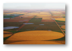
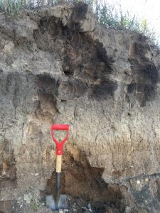
Investigating the Role and Potential of Prairie Pothole Conservation and Restoration to Enhance Carbon Sequestration and Flood Attenuation
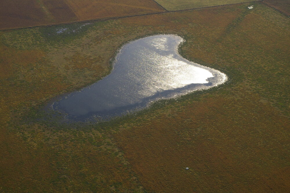
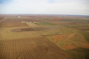
This research is focused in southern Minnesota and the purpose is to determine if restoring previously farmed prairie potholes is effective at enhancing the ability of potholes to sequester carbon in their soils and to store rainfall and snow melt to reduce flooding. The role of potholes in storing carbon and runoff is particularly important for Minnesota since it is part of the Prairie Pothole Region and includes some of the highest wetland densities in the world. It has been estimated that historically southern Minnesota had more than 7 million acres of potholes, but only about 1 million acres remain. Given the dramatic decline in prairie potholes, there has been renewed interest in conserving the remaining potholes and restoring previously farmed potholes.
Recently, Minnesota has experienced more frequent and intense droughts, heat waves, storms, and flooding. Restoring and conserving prairie potholes can help to mitigate these impacts because potholes can reduce flooding and provide water during droughts by temporarily storing storm runoff. Additionally, modern climate change is primarily attributed to increased greenhouse gas concentrations in the atmosphere, in particular carbon dioxide (CO2), and wetland soils are especially effective at storing carbon due to their high plant productivity and prolonged saturation and anoxic conditions.
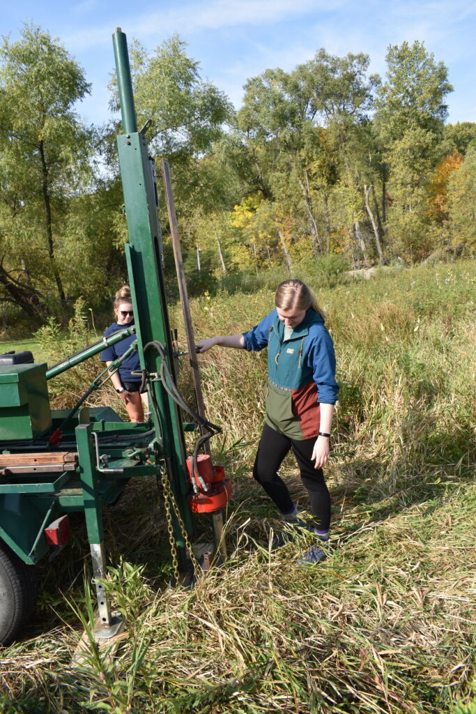
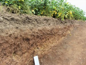
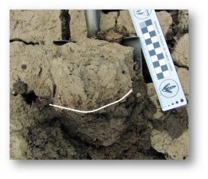
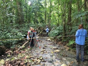
To examine the role of prairie potholes in carbon sequestration and flood attenuation, potholes under a range of land use and land cover conditions are examined (e.g., long-term cropland, native grassland, a different periods of restoration). Research includes GIS analysis of potholes and watersheds to model runoff and water storage potential and collection and analysis of soil cores within and surrounding potholes to determine soil organic carbon content and other soil properties.
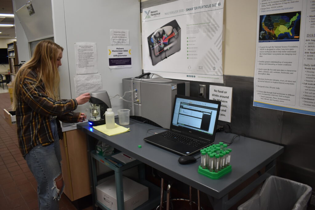
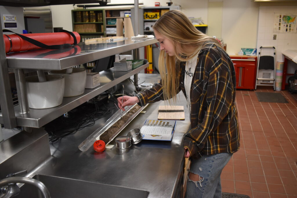
Cores are analyzed for a variety of properties including color, particle size, total organic carbon content, total nitrogen content, and bulk density. This research takes a landscape-scale approach by utilizing remote sensing/GIS techniques to assess pothole and watershed morphology and land use history.
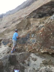
Land Use & Climate Change Impacts on Playa-Lunette Systems
This research is primarily focused on the High Plains region of the central United States, but I have also investigated playas in the Harney Basin in southeast Oregon and on the Owyhee Plateau or northern Nevada.
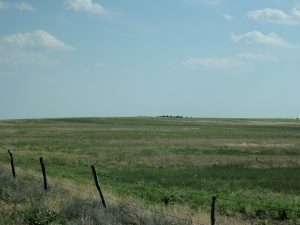
Playa wetlands are small, ephemeral, internally-drained wetlands found throughout arid and semi-arid regions around the world. They are particularly abundant on the High Plains of the central United States. Playas provide a host of critical functions including wetland habitat, groundwater recharge, surface water storage, and water quality improvements.
Lunettes are isolated dunes found on the downwind margin of some playas. They are formed from regional dust fall as well as material blown out of the adjacent playas. Together these playa-lunette systems preserve detailed records of environmental change extending back as much as 125,000 years.
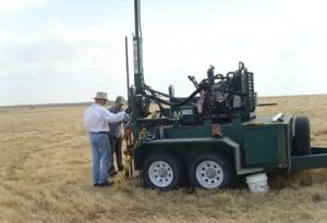
I conduct land-surveys and collect soil cores from playas and lunettes throughout the High Plains, with an emphasis on western Kansas.
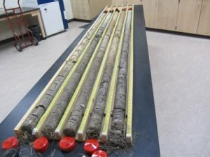
Cores are analyzed for a variety of properties including color, particle size, organic matter content, bulk density, magnetic susceptibility, and stable carbon isotopes. Age control is provided by collecting radiocarbon samples from soils and buried soils identified in soil cores. This research takes a landscape-scale approach by utilizing remote sensing/GIS techniques to assess playa, lunette, and watershed properties.
Investigating the Role of Conservation/Regenerative Agricultural Techniques on Soil Health
This is an emerging research field that is primarily focused on the Great Plains, with an emphasis on southern Minnesota. Decades of intensive agriculture on the Great Plains (and other arable lands around the world) has depleted soils of organic matter, greatly accelerated soil erosion, and degraded surface and groundwater resources.
I work closely with farmers interested in experimenting with soil conservation strategies, such as no-till/reduced-till agriculture, cover crops, livestock rotations, and buffer strips, to monitor changes in soil health.
The goal of this research is to develop and improve upon agricultural techniques that restore soils and improve water resources, as well as increase biodiversity and mitigate climate change, all while making agriculture more profitable, productive, and accessible to the next generation of farmers.
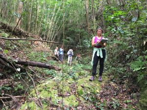
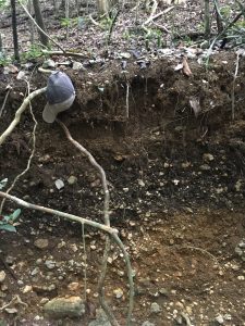
Geomorphic Evolution of Upper Mississippi River Landscapes
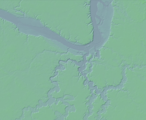
This is a collaborative research project with Dr. Phillip H. Larson and Dr. Ron Schirmer, Minnesota State University, and Dr. Garry Running and Dr. Douglas Faulkner, University of Wisconsin Eau Claire, in which we are examining soils, fluvial and aeolian deposits, and archaeological sites within watersheds tributary to the Upper Mississippi River, including the Minnesota River, Chippewa River, and Cannon River watersheds.
During the Last Glacial Maximum (~25,000 years ago) glaciers advanced south across much of Minnesota and Wisconsin. As the climate warmed, the glaciers melted and began retreating. Glacial meltwater formed enormous lakes throughout the Mississippi River basin such as Glacial Lake Agassiz, Glacial Lake Duluth, Glacial Lake Minnesota, and Glacial Lake Wisconsin.
The upper Mississippi River and associated tributaries are highly geomorphically active today, adjusting to attain a new equilibrium following catastrophic flooding that occurred approximately 15,000 – 10,000 years ago as these meltwater lakes drained rapidly. In particular, Glacial Lake Agassiz, in western Minnesota, over-topped its moraine dam approximately 13,00 years ago, and drained catastrophically forming Glacial River Warren. Glacial River Warren alternately deeply carved out the now Minnesota River Valley and deposits thick sequences of alluvial deposits, resulting in a series of complex river terraces and stratigraphic sequences throughout the valley. This process may have occurred repeatedly as glaciers advanced and retreated.
As the glaciers retreated, extensive deposits of silt-sized material were left on the landscape and blown around by the wind forming thick loess deposits in which soils formed and were subsequently buried. Thus, the Minnesota River Valley, as well as neighboring river valleys, have complex geomorphic landforms and stratigraphic sequences with multiple buried soils.
The goals of this research are to better constrain the timing, geomorphic processes, and environmental conditions that have been impacting the Minnesota River and other tributaries to the Mississippi River.
Past Project – Geomorphic Response of Tropical Rivers to Increased Hurricanes
This collaborative research project included Dr. Robert T. Pavlowsky and Dr. Toby J. Dogwiler, Missouri State University, and Dr. Matthew Connolly, University of Central Arkansas. Research focused on coastal montane rivers of Jamaica, particularly along the southwest coast of Jamaica within the Bluefields Bay region.
Jamaica has a prolonged hurricane history and has experienced a dramatic increase in the number and intensity of hurricanes over the last several decades. Jamaican watersheds are especially susceptible to tropical storm and hurricane impacts due to a history of deforestation beginning in the late 1600s. However, little is known about how geomorphic response has changed over time due to these changes in climate and land use. The goals of this project were to identify and characterize the geomorphic response of coastal montane streams to deforestation and increased frequency and intensity of tropical storms and hurricanes in southwest Jamaica and model potential future response based on predicted land use and climate change scenarios.
This project incorporated computer-based GIS techniques, field-based surveys, and stream channel and floodplain soil/sediment profile descriptions to: 1) document baseline conditions in Jamaican streams, 2) develop river regime equations based on relationships among channel and watershed properties and rainfall-controlled discharge patterns, 3) examine stream channel erosion and deposition patterns from headwaters to the mouth to understand impacts to the surrounding landscape; and 4) create scale-independent models of geomorphic response of streams to land use and climate change.